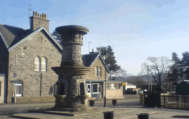
Kingussie is a small town in the Badenoch and Strathspey ward of the Highland council area, and the case for coming down from Aviemore rests on two free, open-air sites on the floodplain of the Spey: Ruthven Barracks, a Hanoverian ruin standing on a green mound, and the RSPB reserve at Insh Marshes. Neither needs a ticket.
The straight-line distance is 17.6 km. It is also 42 miles (68 kilometres) south of Inverness and 3 mi (5 km) north of Newtonmore. The A9 runs past it, but the old route of that road serves as the town’s main street, bypassed since 1979, so through traffic no longer runs along it.
The shape of the town is the work of the river. The original village lay near the site of Ruthven Barracks and was moved to avoid the flood plain of the Spey; the 4th Duke of Gordon established the modern town on higher ground, laid out on a grid. Growth followed the new bridges over the Spey in 1808 and the Laggan in 1815, and then the railway in 1863, which turned Kingussie into a Victorian resort town. The name comes from the Gaelic Ceann a’ Ghiùthsaich, “Head of the Pine forest”.
Ruthven Barracks were built in the early 18th century on the site of Ruthven Castle, which had been the seat of the Comyns, Lords of Badenoch, in the Middle Ages. Before the Clan Macpherson established themselves in the 14th century the lands of Kingussie and Badenoch were primarily held by the Clan Comyn (Cumming), Earls of Badenoch and a major power in the Highlands; the Macphersons acquired them after supporting Robert the Bruce in expelling the Comyns. Historic Environment Scotland looks after the ruin, and it is open to visitors at all times.
It is the best-reviewed thing here, 4.7 from 1,196 Google reviews, and reviewers agree on the practicalities. A visitor in July 2026 wrote, “Small road side parking and short walk to the ruins. All free.” Another in July 2026 found the interpretation well judged: “Just enough reading material to understand what you are looking at without it being an overwhelming amount to read.” A visitor in August 2026 summarised what is left standing as “The remains of an 18th century citadel meant to hold control over the main roads, felled by the king after a few decades.”
Expect a shell rather than rooms: the draw is the mound, the view over the strath, and that it costs nothing.
The wet ground the town retreated from is now RSPB Insh Marshes, 4.5 from 71 Google reviews — a small sample, so read it lightly. It is free to enter. There is a viewpoint called the Lookout and two bird hides, plus a wildflower meadow by the Tromie.
Two warnings come out of the reviews. The car park is small: a visitor in July 2026 wrote, “A beautiful location with a small free car parking area so best get there early to avoid disappointment.” And the signage cannot be trusted — the same visitor added, “Please note the reserve map on the board is not accurate”.
Manage your expectations about what you will see. A visitor in July 2026 called it a “Free RSPB reserve in a glorious setting” but reported seeing “a heron or two” and nothing much else. Insects can carry the visit when the birds do not: a visitor in August 2026 described “So many butterflies in the woodland and in particular, lots of Scotch Argus I haven’t seen before”, alongside heather and field scabious in flower. The same visitor noted it is “close to the A9 if you’re needing a break from driving”, which is a fair way to think about the stop.
The town is small and the High Street is short. The Iona Gallery carries 4.5 from 31 Google reviews and the Badenoch Centre, a leisure centre, 4.5 from 43, both too small a sample to lean on. The Sugarbowl Cafe and Gifts Shop is the better-tested stop at 4.5 from 522 Google reviews; a visitor in August 2026 called it a “Cozy coffee and gifts place.” Kingussie Golf Club has 4.7 from 187 Google reviews, and a visitor in August 2026 reported the “Course in good condition greens very fast”.
For walkers, the town sits at the centre of a network of well maintained and waymarked footpaths. The most popular is the ascent of Creag Bheag, a prominent hill overlooking the centre. The Speyside Way currently has its southern terminus at Aviemore; a proposed extension to Newtonmore would run through Kingussie, but it is proposed rather than built.
Two other things explain the place. Shinty: the 2005 Guinness World Records named Kingussie the most successful sports club in the world, after 20 consecutive league wins and four unbeaten years in the 1990s. And Gaelic: 53.9% of residents spoke it in 1891, a figure that fell sharply at the turn of the century, with only about 1.8% reporting any proficiency in 2001. The bard Donnchadh Gobha lived out his old age here, and Fr Ranald Rankin, lyricist of the carol Tàladh Chrìosda, raised money for the first post-Reformation Catholic parish church in Badenoch before being transferred to Moidart in 1838, before it was completed.
The train is the established link. Kingussie is on the same Edinburgh and Glasgow to Inverness main line as Aviemore, with services calling here roughly hourly to two-hourly; from Aviemore you want a southbound train. Kingussie railway station is about 200 yards (200 metres) southeast of the High Street, so the town is walkable on arrival. The station holds 4.4 from 19 Google reviews, too few to mean much.
No bus service between Aviemore and Kingussie is established in the sources behind this page, so do not plan on one without checking. By road it is the A9, with the bypassed old road delivering you onto the main street.
Bike hire is on the High Street: Bothy Bikes at number 56, 4.8 from 102 Google reviews, 18.6 km from the Aviemore centre. Van travellers have the Kingussie Camping and Motorhome Aire at Croila Croft by the railway station, 3.9 from 68 Google reviews — noticeably weaker than anything else here.
The village and what is around it, at walking scale.
Open any of them in Google Maps for directions and current opening.
Want live prices and dates? GetYourGuide's booking widget shows them, and sets their cookies in your browser when it loads.
Background on Kingussie draws on its Wikipedia article, text there being available under CC BY-SA 4.0.